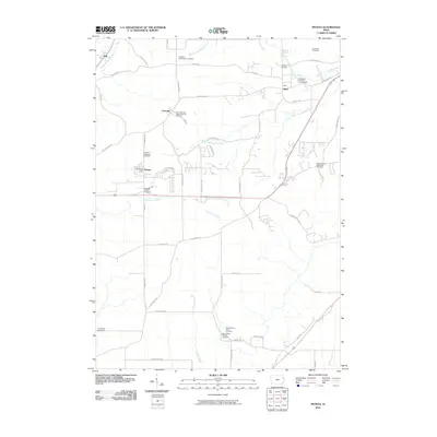
2010 Map of Peosta
USGS Topo · Published 2010About this map
Peosta serves as a central hub in this section of Dubuque County, where a grid of rural roads connects several established settlements and local historical sites. The landscape is defined by the drainage patterns of Whitewater Creek and the multiple branches of Middle Fork Catfish Creek, which dictate the placement of early homesteads and transport corridors. Genealogists will find a high concentration of burial sites, including the New Melleray Abbey Cemetery near the southern boundary and the Saint John the Baptist Catholic Cemetery in Centralia. The geography reflects a transition from agricultural land to regional infrastructure, seen in the proximity of the Dubuque County Fairgrounds to the small community of Julien. Cultural markers like the Peosta Post Office and the Michael Schmitt Cemetery offer specific points of reference for those tracing family lineage or early 21st-century development in the Iowa interior.
Find a feature on this map
51 named features on this map. Tap any name to fly to it.
Don’t see what you’re looking for? This feature index may not catch every label — zoom into the map to look around manually.
Map Details
Editions of this 2010 Peosta Map
This is the sole edition of this map. No revisions or reprints were ever made.
Other maps of this area

1900 · Lancaster
USGS Topo · 1:125,000

1901 · Peosta
USGS Topo · 1:125,000

1904 · Lancaster
USGS Topo · 1:125,000

1908 · Lancaster
USGS Topo · 1:125,000

1935 · East Dubuque
USGS Topo · 1:62,500

1940 · East Dubuque
USGS Topo · 1:62,500

1955 · Dubuque South
USGS Topo · 1:24,000

1956 · Dubuque North
USGS Topo · 1:24,000

1956 · Sherrill
USGS Topo · 1:24,000

1957 · Holy Cross
USGS Topo · 1:24,000