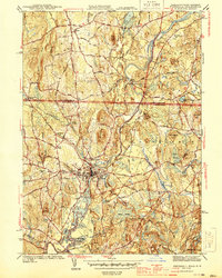
1944 Map of Pepperell
USGS Topo · Published 1944About this map
The Nashua River meanders through the heart of this mid-century borderland between Massachusetts and New Hampshire, defining the settlement patterns of Pepperell and East Pepperell. The landscape is a network of water-driven geography, where the Nissitissit River joins the Nashua near the Boston and Maine Railroad corridor. This rail line serves as a vital artery, connecting localized industrial points like the Hollis Depot and Runnells Bridge to the broader regional economy.
Find a feature on this map
73 named features on this map. Tap any name to fly to it.
Don’t see what you’re looking for? This feature index may not catch every label — zoom into the map to look around manually.
Map Details
Editions of this 1944 Pepperell Map
2 editions found
Other maps of this area

1886 · Lowell
USGS Topo · 1:62,500

1893 · Lowell
USGS Topo · 1:62,500

1893 · Groton
USGS Topo · 1:62,500

1905 · Manchester
USGS Topo · 1:62,500

1906 · Milford
USGS Topo · 1:62,500

1918 · Lowell
USGS Topo · 1:62,500

1921 · Lowell
USGS Topo · 1:62,500

1931 · Lowell
USGS Topo · 1:48,000

1931 · Groton
USGS Topo · 1:48,000

1935 · Ayer
USGS Topo · 1:24,000