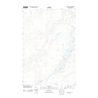
2013 Map of Pequaywan Lake
USGS Topo · Published 2013About this map
Pequaywan Lake and the surrounding drainage basin of the Cloquet River define this section of the Minnesota Northwoods. This 2013 survey illustrates a landscape dominated by glacial lakes and wetlands, where the W Br Cloquet River and the Little Cloquet River wind through the timberland. Local transit is centered on the Pequaywan Lake Rd, which provides the primary access to seasonal cabins and permanent residences near Warren Lake and Wet Lake. The naming of smaller bodies of water like Santa Claus Lake, Wigwam Lake, and Holmsey Lake suggests a history of local lore and recreational settlement. Aside from the established road network, including W Branch Rd and River Rd, the area remains characterized by its dense water network and minimal industrial footprint.
Find a feature on this map
30 named features on this map. Tap any name to fly to it.
Don’t see what you’re looking for? This feature index may not catch every label — zoom into the map to look around manually.
Map Details
Editions of this 2013 Pequaywan Lake Map
This is the sole edition of this map. No revisions or reprints were ever made.
Other maps of this area

1954 · Barrs Lake
USGS Topo · 1:24,000

1954 · Thompson Lake
USGS Topo · 1:24,000

1954 · Mc Carthy Creek
USGS Topo · 1:24,000

1954 · Two Harbors
USGS Topo · 1:250,000

1954 · Hibbing
USGS Topo · 1:250,000

1956 · Pequaywan Lake
USGS Topo · 1:24,000

1956 · King Lake
USGS Topo · 1:24,000

1957 · Two Harbors
USGS Topo · 1:250,000

1957 · Hibbing
USGS Topo · 1:250,000

1957 · Brimson
USGS Topo · 1:62,500