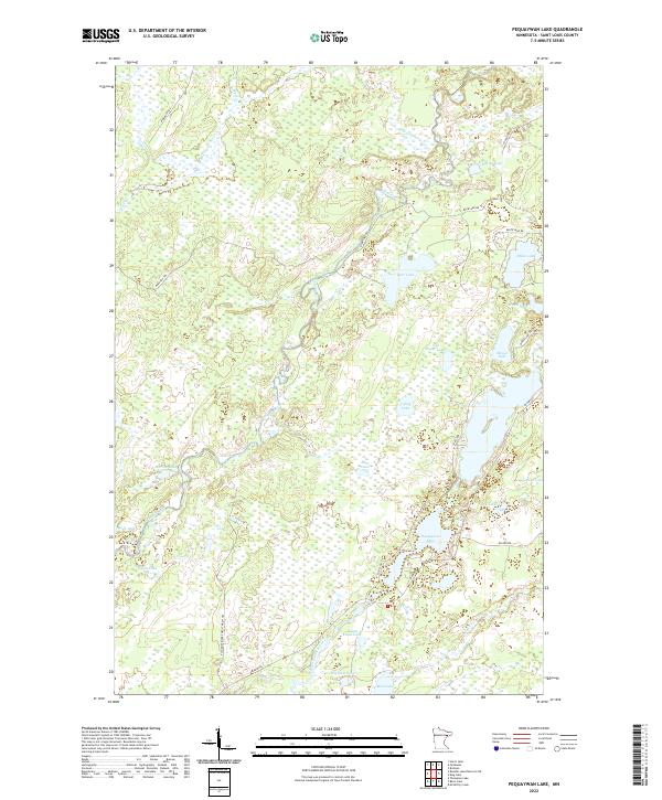
2022 Map of Pequaywan Lake
USGS Topo · Published 2022About this map
Pequaywan Lake serves as a central landmark in this part of St. Louis County, where the Cloquet River and its various branches, including the W Br Cloquet River and Little Cloquet River, define the hydrology of the Northwoods. The landscape is characterized by an extensive network of water bodies such as Santa Claus Lake, Marion Lake, and Wigwam Lake, connected by forest management routes like the E Cloquet River Forest Mgmt Trl.
Find a feature on this map
38 named features on this map. Tap any name to fly to it.
Don’t see what you’re looking for? This feature index may not catch every label — zoom into the map to look around manually.
Map Details
Editions of this 2022 Pequaywan Lake Map
This is the sole edition of this map. No revisions or reprints were ever made.
Other maps of this area

1954 · Barrs Lake
USGS Topo · 1:24,000

1954 · Thompson Lake
USGS Topo · 1:24,000

1954 · Mc Carthy Creek
USGS Topo · 1:24,000

1954 · Two Harbors
USGS Topo · 1:250,000

1954 · Hibbing
USGS Topo · 1:250,000

1956 · Pequaywan Lake
USGS Topo · 1:24,000

1956 · King Lake
USGS Topo · 1:24,000

1957 · Two Harbors
USGS Topo · 1:250,000

1957 · Hibbing
USGS Topo · 1:250,000

1957 · Brimson
USGS Topo · 1:62,500