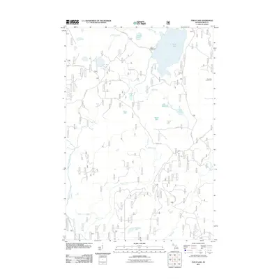
2011 Map of Perch Lake
USGS Topo · Published 2011About this map
Perch Lake and its surrounding wetlands dominate this 2011 survey of Iron County, Michigan. The landscape is defined by an intricate network of waterways, including the meandering North Branch Paint River and Silver Creek, which cut through the dense timberland of the Upper Peninsula. Human presence is largely concentrated around recreational and forest management infrastructure, such as the Perch Lake Campground and the Perch Lake Lookout Tower, situated at a high point overlooking the basin. The map reveals an extensive system of forest roads, notably Perch Lake Rd and Ponozzo Rd, providing access to isolated water bodies like Ponozzo Lake and Petrow Lake. This network of unpaved tracks and forest service routes reflects the area's ongoing use for timber management and outdoor recreation within the state's rugged interior.
Find a feature on this map
34 named features on this map. Tap any name to fly to it.
Don’t see what you’re looking for? This feature index may not catch every label — zoom into the map to look around manually.
Map Details
Editions of this 2011 Perch Lake Map
This is the sole edition of this map. No revisions or reprints were ever made.
Other maps of this area

1895 · Perch Lake
USGS Topo · 1:62,500

1898 · Iron River
USGS Topo · 1:62,500

1945 · Gibbs City
USGS Topo · 1:24,000

1945 · Sunset Lake
USGS Topo · 1:24,000

1946 · Sunset Lake
USGS Topo · 1:31,680

1946 · Gibbs City
USGS Topo · 1:31,680

1954 · Kenton
USGS Topo · 1:62,500

1954 · Perch Lake
USGS Topo · 1:62,500

1956 · Beechwood
USGS Topo · 1:62,500

1958 · Iron River
USGS Topo · 1:250,000