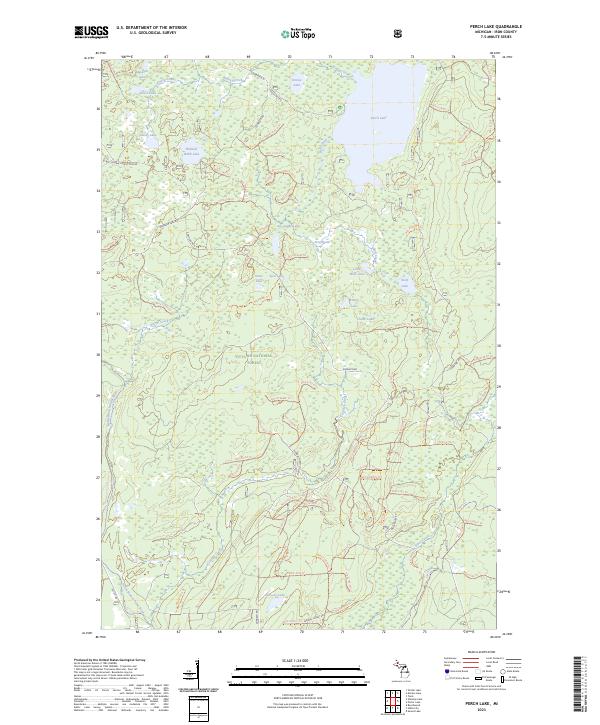
2023 Map of Perch Lake
USGS Topo · Published 2023About this map
The Ottawa National Forest dominates this landscape in Michigan's Upper Peninsula, defined by a dense network of glacial lakes and northern waterways. Centered on the large expanse of Perch Lake, the area is punctuated by smaller bodies of water such as Hannah Webb Lake, Petrow Lake, and Muskrat Lake. The western edge of the quadrangle is marked by the Paint Wild and Scenic River, which is fed by tributaries including Knave Creek and Stump Creek. A complex system of forest roads and trails, including Ponozzo Rd and Federal Forest Rd, provides access to this remote timberland. Numerous marked trails, such as Nfst-2143 Trl and Nfst-2135 Trl, suggest a region managed primarily for recreation and forestry, where the natural hydrology of places like Frog Pond and Golden Creek remains largely undisturbed.
Find a feature on this map
89 named features on this map. Tap any name to fly to it.
Don’t see what you’re looking for? This feature index may not catch every label — zoom into the map to look around manually.
Map Details
Editions of this 2023 Perch Lake Map
This is the sole edition of this map. No revisions or reprints were ever made.
Other maps of this area

1895 · Perch Lake
USGS Topo · 1:62,500

1898 · Iron River
USGS Topo · 1:62,500

1945 · Gibbs City
USGS Topo · 1:24,000

1945 · Sunset Lake
USGS Topo · 1:24,000

1946 · Sunset Lake
USGS Topo · 1:31,680

1946 · Gibbs City
USGS Topo · 1:31,680

1954 · Kenton
USGS Topo · 1:62,500

1954 · Perch Lake
USGS Topo · 1:62,500

1956 · Beechwood
USGS Topo · 1:62,500

1958 · Iron River
USGS Topo · 1:250,000