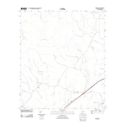
2011 Map of Perdido
USGS Topo · Published 2011About this map
The settlement of Rabun and the community of Perdido anchor this 2011 survey of northern Baldwin County, Alabama. The landscape is defined by a dense network of watercourses including Dyas Creek, Beard Creek, and Majors Creek, which wind through the terrain alongside numerous named branches like Stage Stand Branch and Schoolhouse Branch. This topography suggests a history of localized water-powered industry or early transportation routes along these natural drainage systems. For genealogists and local historians, several family-linked burial sites are clearly marked, such as Gentry Cemetery near Paul Rd and the Bryars McGill Cemetery and McGill Cemetery cluster farther south. The map documents an extensive rural road system, from Splinter Hill Rd to Tab Turberville Rd, reflecting a dispersed agricultural or forestry-based population that relies on these arteries to connect the smaller hamlets and family homesteads.
Find a feature on this map
51 named features on this map. Tap any name to fly to it.
Don’t see what you’re looking for? This feature index may not catch every label — zoom into the map to look around manually.
Map Details
Editions of this 2011 Perdido Map
This is the sole edition of this map. No revisions or reprints were ever made.
Other maps of this area

1941 · Bay Minette
USGS Topo · 1:62,500

1942 · Perdido
USGS Topo · 1:62,500

1942 · Dyas
USGS Topo · 1:62,500

1943 · Bay Minette
USGS Topo · 1:62,500

1943 · Tensaw
USGS Topo · 1:62,500

1944 · Tensaw
USGS Topo · 1:62,500

1944 · Dyas
USGS Topo · 1:62,500

1944 · Perdido
USGS Topo · 1:62,500

1953 · Andalusia
USGS Topo · 1:250,000

1957 · Andalusia
USGS Topo · 1:250,000