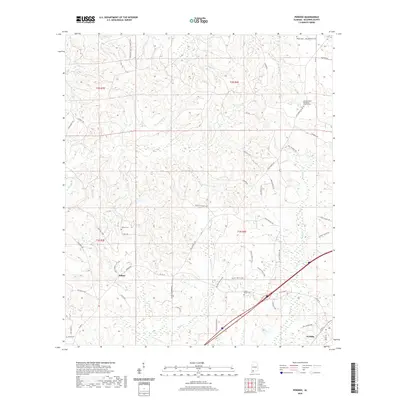
2020 Map of Perdido
USGS Topo · Published 2020About this map
Perdido and Rabun anchor this 2020 landscape in northeastern Baldwin County, where the topography is defined by an intricate network of creek branches and drainage runs. Notable waterways such as Majors Cr and Dyas Cr carve through the terrain, illustrating the rural character of the region. Family and community history are preserved in several local burial grounds, including Millers Cem, Gentry Cem, and the Bryars-McGill Cem. Near the northern edge, the Lottie United Methodist Church and its associated cemetery serve as focal points for the local community. A unique contemporary feature is the Pitcher Plant Loop, indicating a focus on the region's specific botanical heritage and wetland environments. Numerous family-named roads like Jim Hadley Rd and George Thomley Rd suggest long-standing land tracts and local genealogy.
Find a feature on this map
57 named features on this map. Tap any name to fly to it.
Don’t see what you’re looking for? This feature index may not catch every label — zoom into the map to look around manually.
Map Details
Editions of this 2020 Perdido Map
This is the sole edition of this map. No revisions or reprints were ever made.
Other maps of this area

1941 · Bay Minette
USGS Topo · 1:62,500

1942 · Perdido
USGS Topo · 1:62,500

1942 · Dyas
USGS Topo · 1:62,500

1943 · Bay Minette
USGS Topo · 1:62,500

1943 · Tensaw
USGS Topo · 1:62,500

1944 · Tensaw
USGS Topo · 1:62,500

1944 · Dyas
USGS Topo · 1:62,500

1944 · Perdido
USGS Topo · 1:62,500

1953 · Andalusia
USGS Topo · 1:250,000

1957 · Andalusia
USGS Topo · 1:250,000