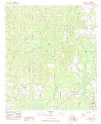
1983 Map of Perdido
USGS Topo · Published 1983About this map
Perdido and the surrounding Baldwin County timberlands are defined by a complex network of southern Alabama drainage systems in the early 1980s. The landscape is carved by the winding paths of Dyas Creek, Bushy Creek, and Majors Creek, which dictate the placement of early settlements and rural infrastructure. Small community hubs like Rabun and Lottie are anchored by local landmarks such as Guys Chapel and New Home Ch.
Find a feature on this map
29 named features on this map. Tap any name to fly to it.
Don’t see what you’re looking for? This feature index may not catch every label — zoom into the map to look around manually.
Map Details
Editions of this 1983 Perdido Map
This is the sole edition of this map. No revisions or reprints were ever made.
Other maps of this area

1941 · Bay Minette
USGS Topo · 1:62,500

1942 · Perdido
USGS Topo · 1:62,500

1942 · Dyas
USGS Topo · 1:62,500

1943 · Bay Minette
USGS Topo · 1:62,500

1943 · Tensaw
USGS Topo · 1:62,500

1944 · Tensaw
USGS Topo · 1:62,500

1944 · Dyas
USGS Topo · 1:62,500

1944 · Perdido
USGS Topo · 1:62,500

1953 · Andalusia
USGS Topo · 1:250,000

1957 · Andalusia
USGS Topo · 1:250,000