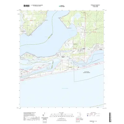
2021 Map of Perdido Bay
USGS Topo · Published 2021About this map
Perdido Bay serves as the central geographic feature of this coastal region, where the state boundary between Baldwin County, Alabama and Escambia County, Florida follows the deep water of the bay and its surrounding inlets. The Alabama shoreline is defined by the settlement of Perdido Beach and the high ground of Red Bluff, while the Florida side includes the marshy reaches of Tarkiln Bayou and the protected lands of Tarkiln Bayou Preserve State Park. To the south, the barrier island complex is dominated by Perdido Key and Ono Island, separated from the mainland by the Intracostal Waterway and the narrow channel of Old River.
Find a feature on this map
101 named features on this map. Tap any name to fly to it.
Don’t see what you’re looking for? This feature index may not catch every label — zoom into the map to look around manually.
Map Details
Editions of this 2021 Perdido Bay Map
This is the sole edition of this map. No revisions or reprints were ever made.
Other maps of this area

1921 · Bon Secour
USGS Topo · 1:62,500

1921 · Fort Barrancas
USGS Topo · 1:62,500

1941 · Fort Barrancas
USGS Topo · 1:62,500

1941 · Foley
USGS Topo · 1:62,500

1943 · Fort Barrancas
USGS Topo · 1:62,500

1943 · Foley
USGS Topo · 1:62,500

1944 · Perdido Bay North
USGS Topo · 1:25,000

1944 · Miflin
USGS Topo · 1:25,000

1944 · West Pensacola
USGS Topo · 1:25,000

1944 · Perdido Bay South
USGS Topo · 1:25,000
Featured Places
- Perdido Beach, AL
- Chanticleer, FL
- Gulf Beach Heights, FL
- Perdido Bay Country Club Estates, FL
- Treasure Hill Park, FL