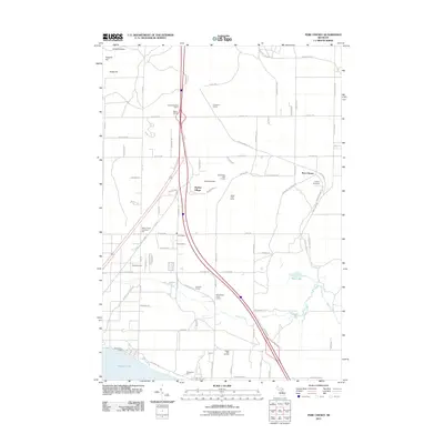
2011 Map of Pere Cheney
USGS Topo · Published 2011About this map
Pere Cheney and its adjacent Cheney Cemetery occupy the northeastern plateau of this landscape, a region historically shaped by the timber industry and the railroad. The layout of the modern transportation corridor, dominated by the interstate, cuts a sharp north-south path through the center of the quadrangle, yet many older landmarks remain visible. Scattered cabin settlements and recreational sites like Leykaufs Cabins, Bakers Cabins, and Skyline Village indicate the transition from early logging and rail stops like Horrigans Siding toward a seasonal and residential community. The southern portion of the map is defined by the waters of Higgins Lake and its corresponding Higgins Lake State Park, where the local terrain slopes toward the winding path of Beaver Creek and the marshy edges of Mud Lake.
Find a feature on this map
89 named features on this map. Tap any name to fly to it.
Don’t see what you’re looking for? This feature index may not catch every label — zoom into the map to look around manually.
Map Details
Editions of this 2011 Pere Cheney Map
This is the sole edition of this map. No revisions or reprints were ever made.
Other maps of this area

1949 · Fletcher
USGS Topo · 1:62,500

1949 · Grayling
USGS Topo · 1:62,500

1950 · Cote Dame Marie
USGS Topo · 1:24,000

1950 · Lake Margrethe
USGS Topo · 1:24,000

1950 · Grayling
USGS Topo · 1:24,000

1950 · Roscommon North
USGS Topo · 1:24,000

1951 · Wakeley Lake
USGS Topo · 1:24,000

1951 · Grayling
USGS Topo · 1:24,000

1951 · Roscommon North
USGS Topo · 1:24,000

1951 · Pere Cheney
USGS Topo · 1:24,000
Featured Places
- Beaver Creek Township, MI
- Pere Cheney, MI
- Skyline Village, MI
- Grayling Charter Township, MI
- Gerrish Township, MI