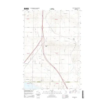
2014 Map of Pere Cheney
USGS Topo · Published 2014About this map
Pere Cheney sits at the heart of this landscape, positioned along the historic route of the E Railroad Trl. The area is defined by the winding course of Beaver Creek, which flows through the southern half of the township toward the northern edge of Higgins Lake. This map captures a transition in the local geography, where the glacial terrain of Hogarth Hill and Sinke Hill meets the low-lying wetlands surrounding Mud Lake. Local history and genealogy researchers will find significant interest in the Cheney Cem, a lonely landmark near the village site. The map further documents the modern residential footprint of Skyline Village and the rural layout of Juvigny Valley, providing a clear look at how transportation corridors and water systems have shaped settlement in this part of Crawford County.
Find a feature on this map
78 named features on this map. Tap any name to fly to it.
Don’t see what you’re looking for? This feature index may not catch every label — zoom into the map to look around manually.
Map Details
Editions of this 2014 Pere Cheney Map
This is the sole edition of this map. No revisions or reprints were ever made.
Other maps of this area

1949 · Fletcher
USGS Topo · 1:62,500

1949 · Grayling
USGS Topo · 1:62,500

1950 · Cote Dame Marie
USGS Topo · 1:24,000

1950 · Lake Margrethe
USGS Topo · 1:24,000

1950 · Grayling
USGS Topo · 1:24,000

1950 · Roscommon North
USGS Topo · 1:24,000

1951 · Wakeley Lake
USGS Topo · 1:24,000

1951 · Grayling
USGS Topo · 1:24,000

1951 · Roscommon North
USGS Topo · 1:24,000

1951 · Pere Cheney
USGS Topo · 1:24,000
Featured Places
- Beaver Creek Township, MI
- Pere Cheney, MI
- Skyline Village, MI
- Grayling Charter Township, MI
- Gerrish Township, MI