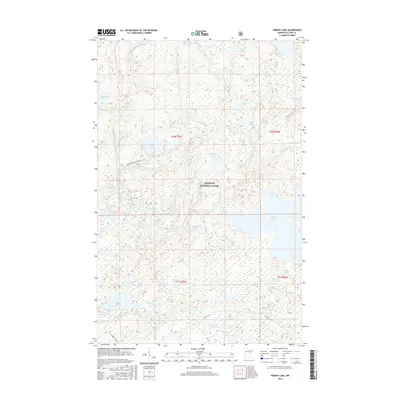
2016 Map of Perent Lake
USGS Topo · Published 2016About this map
Superior National Forest defines the landscape of this Lake County region, where an intricate network of glacial lakes and slow-moving waterways create a complex aquatic environment. The massive Perent Lake dominates the eastern section, fed and drained by the Perent River, while the southern reaches are shaped by the Island River and the meandering Dumbbell River. This 2016 survey documents the untouched character of the Boundary Waters vicinity, highlighting a wilderness accessible largely by water and trail.
Find a feature on this map
36 named features on this map. Tap any name to fly to it.
Don’t see what you’re looking for? This feature index may not catch every label — zoom into the map to look around manually.
Map Details
Editions of this 2016 Perent Lake Map
This is the sole edition of this map. No revisions or reprints were ever made.
Other maps of this area

1954 · Two Harbors
USGS Topo · 1:250,000

1955 · Isabella
USGS Topo · 1:62,500

1955 · Cramer
USGS Topo · 1:62,500

1957 · Two Harbors
USGS Topo · 1:250,000

1958 · Two Harbors
USGS Topo · 1:250,000

1960 · Lake Polly
USGS Topo · 1:24,000

1960 · Kawishiwi Lake
USGS Topo · 1:24,000

1960 · Perent Lake
USGS Topo · 1:24,000

1960 · Alice Lake
USGS Topo · 1:24,000

1964 · Two Harbors
USGS Topo · 1:250,000