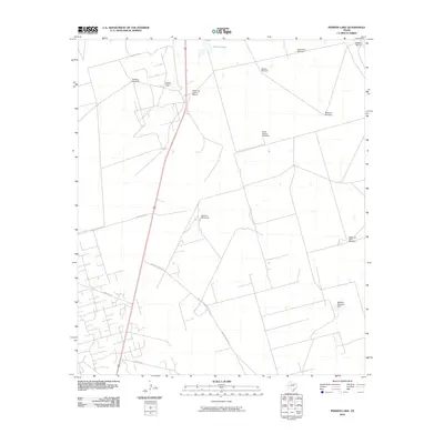
2010 Map of Perkins Lake
USGS Topo · Published 2010About this map
The Concho Bluff Oil Field defines the industrial character of this West Texas landscape, where energy extraction meets traditional ranching operations. Sparse water resources, centered on the ephemeral Perkins Lake and the McElroy Reservoir Dam, dictate the placement of human activity across Crane County. A network of private ranch roads, including McElroy Ranch Rd and McElroy Headquarters Rd, connects isolated outposts like the Railway Ranch and the Glass and Everitt Ranch. The map's most striking feature is the density of named water-pumping landmarks, such as the Pee Wee Windmill, West Shillie Windmill, and the Shearing Pens Windmill. These labeled structures provide essential waypoints for local history researchers and genealogists tracing the infrastructure of early 21st-century West Texas cattle and oil country.
Find a feature on this map
17 named features on this map. Tap any name to fly to it.
Don’t see what you’re looking for? This feature index may not catch every label — zoom into the map to look around manually.
Map Details
Editions of this 2010 Perkins Lake Map
This is the sole edition of this map. No revisions or reprints were ever made.
Other maps of this area

1928 · Crane
USGS Topo · 1:125,000

1954 · Pecos
USGS Topo · 1:250,000

1957 · Pecos
USGS Topo · 1:250,000

1964 · Doodle Bug Well
USGS Topo · 1:24,000

1964 · Clark Brothers Ranch
USGS Topo · 1:24,000

1964 · Perkins Lake
USGS Topo · 1:24,000

1965 · South Cowden Ranch
USGS Topo · 1:24,000

1968 · Benge Corner NW
USGS Topo · 1:24,000

1968 · Benge Corner SW
USGS Topo · 1:24,000

1971 · McElroy Ranch
USGS Topo · 1:24,000