
1968 Map of Benge Corner SW
USGS Topo · Published 1970About this map
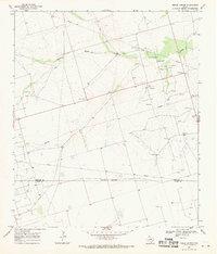
The industrial energy landscape of West Texas is the primary feature of this survey, dominated by the sprawling Pegasus Oil Field and Davis Oil Field. These expansive petroleum developments are overlaid upon a high desert terrain marked by a network of pipelines and service roads. Evidence of ranching operations remains visible at Barr Ranch, while the small settlement of Manning sits near the oil field boundaries. Water management in this arid environment is highlighted by infrastructure such as Bug Windmill and various isolated tanks. The presence of numerous Gravel Pits alongside state routes Tex. 1787 and Tex. 329 illustrates the infrastructure required to support the region's extractive economy. A prominent Radio Tower serves as a lone navigational landmark in a territory otherwise defined by the grid of oil exploration and large-scale land holdings.
Find a feature on this map
13 named features on this map. Tap any name to fly to it.
Don’t see what you’re looking for? This feature index may not catch every label — zoom into the map to look around manually.
Map Details
Editions of this 1968 Benge Corner SW Map
This is the sole edition of this map. No revisions or reprints were ever made.
Other maps of this area

1928 · Crane
USGS Topo · 1:125,000

1954 · Pecos
USGS Topo · 1:250,000

1957 · Pecos
USGS Topo · 1:250,000

1964 · Perkins Lake
USGS Topo · 1:24,000

1965 · South Cowden Ranch
USGS Topo · 1:24,000

1968 · Benge Corner SE
USGS Topo · 1:24,000

1968 · Benge Corner NW
USGS Topo · 1:24,000
1968 · Benge Corner
USGS Topo · 1:24,000
1971 · Hanks Ranch
USGS Topo · 1:24,000

1971 · McElroy Ranch
USGS Topo · 1:24,000