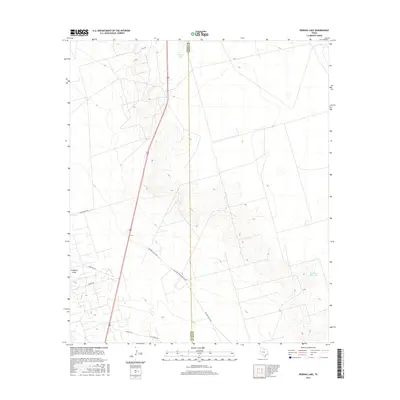
2016 Map of Perkins Lake
USGS Topo · Published 2016About this map
Perkins Lake sits at the northern edge of the boundary between Crane and Upton counties in West Texas. The landscape is defined by the ephemeral Landreth Draw and several managed water features, including the McElroy Reservoir. This 2016 survey highlights a sparse infrastructure dominated by ranch and service roads, reflecting the region's historical ties to large-scale cattle ranching and modern resource management. The convergence of McElroy Ranch Rd and Mc Elroy Headquarters Rd suggests a landscape organized around centralized ranching operations. Significant local thoroughfares like Farm Rd 1233 and Tarpley Rd provide access through the open terrain, connecting the isolated landmarks across this portion of the Permian Basin.
Find a feature on this map
12 named features on this map. Tap any name to fly to it.
Don’t see what you’re looking for? This feature index may not catch every label — zoom into the map to look around manually.
Map Details
Editions of this 2016 Perkins Lake Map
This is the sole edition of this map. No revisions or reprints were ever made.
Other maps of this area

1928 · Crane
USGS Topo · 1:125,000

1954 · Pecos
USGS Topo · 1:250,000

1957 · Pecos
USGS Topo · 1:250,000

1964 · Doodle Bug Well
USGS Topo · 1:24,000

1964 · Clark Brothers Ranch
USGS Topo · 1:24,000

1964 · Perkins Lake
USGS Topo · 1:24,000

1965 · South Cowden Ranch
USGS Topo · 1:24,000

1968 · Benge Corner NW
USGS Topo · 1:24,000

1968 · Benge Corner SW
USGS Topo · 1:24,000

1971 · McElroy Ranch
USGS Topo · 1:24,000