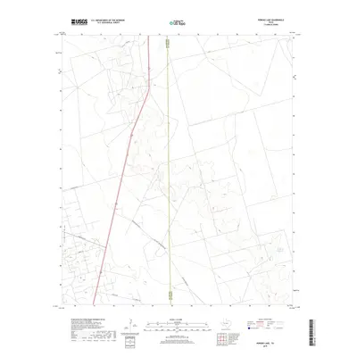
2019 Map of Perkins Lake
USGS Topo · Published 2019About this map
The boundary between Crane and Upton Counties runs through this West Texas landscape, defined by ranching infrastructure and the drainage patterns of the Permian Basin. Landreth Draw cuts through the western portion of the terrain, while the eastern section is dominated by the McElroy Reservoir. This modern survey reveals a network of industrial and rural access routes, including Mc Elroy Ranch Rd and Mc Elroy Headquarters Rd, which signify the area's ongoing importance to the regional ranching and oil economies. Local transit is supported by Farm Rd 1233 and a series of named paths such as Mobile Rd and Tarpley Rd. The sparse distribution of named points highlights a working landscape where water management and transportation are the primary markers of human activity.
Find a feature on this map
11 named features on this map. Tap any name to fly to it.
Don’t see what you’re looking for? This feature index may not catch every label — zoom into the map to look around manually.
Map Details
Editions of this 2019 Perkins Lake Map
This is the sole edition of this map. No revisions or reprints were ever made.
Other maps of this area

1928 · Crane
USGS Topo · 1:125,000

1954 · Pecos
USGS Topo · 1:250,000

1957 · Pecos
USGS Topo · 1:250,000

1964 · Doodle Bug Well
USGS Topo · 1:24,000

1964 · Clark Brothers Ranch
USGS Topo · 1:24,000

1964 · Perkins Lake
USGS Topo · 1:24,000

1965 · South Cowden Ranch
USGS Topo · 1:24,000

1968 · Benge Corner NW
USGS Topo · 1:24,000

1968 · Benge Corner SW
USGS Topo · 1:24,000

1971 · McElroy Ranch
USGS Topo · 1:24,000