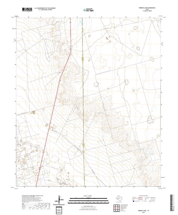
2022 Map of Perkins Lake
USGS Topo · Published 2022About this map
Perkins Lake and the drainage of Landreth Draw characterize this West Texas landscape along the border of Crane and Upton counties. The terrain is defined by ranching infrastructure and a network of roads that service the high plains, including Mc Elroy Ranch Rd and Mc Elroy Headquarters Rd. These family-named landmarks and headquarters locations signify the long-standing livestock operations that have shaped land use in this part of the Permian Basin for generations.
Find a feature on this map
12 named features on this map. Tap any name to fly to it.
Don’t see what you’re looking for? This feature index may not catch every label — zoom into the map to look around manually.
Map Details
Editions of this 2022 Perkins Lake Map
This is the sole edition of this map. No revisions or reprints were ever made.
Other maps of this area

1928 · Crane
USGS Topo · 1:125,000

1954 · Pecos
USGS Topo · 1:250,000

1957 · Pecos
USGS Topo · 1:250,000

1964 · Doodle Bug Well
USGS Topo · 1:24,000

1964 · Clark Brothers Ranch
USGS Topo · 1:24,000

1964 · Perkins Lake
USGS Topo · 1:24,000

1965 · South Cowden Ranch
USGS Topo · 1:24,000

1968 · Benge Corner NW
USGS Topo · 1:24,000

1968 · Benge Corner SW
USGS Topo · 1:24,000

1971 · McElroy Ranch
USGS Topo · 1:24,000