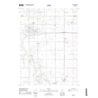
2018 Map of Perry
USGS Topo · Published 2018About this map
The Perry city grid dominates the northwestern corner of this Dallas County landscape, where the confluence of regional drainage and modern transport networks is clearly visible. The North Raccoon River winds through the southwestern quadrant, joined by tributaries such as Elm Br and Swan Lake Br. This 2018 survey reveals a high density of burial sites and memorial grounds, including Violet Hill Cem and Saint Patrick's Cem near the city center, and the more remote Myers Cem and Elmwood Cem further south. The map documents the transition from the dense urban streets of Perry, like Willis Ave and Otley Ave, to the outlying agricultural communities of Bouton, Gardiner, and Minburn. Infrastructure landmarks like Beaver Creek Bridge and Graney Bridge highlight the essential crossings over Beaver Cr and the river that have shaped local travel patterns for generations.
Find a feature on this map
68 named features on this map. Tap any name to fly to it.
Don’t see what you’re looking for? This feature index may not catch every label — zoom into the map to look around manually.
Map Details
Editions of this 2018 Perry Map
This is the sole edition of this map. No revisions or reprints were ever made.
Other maps of this area

1908 · Waukee
USGS Topo · 1:62,500

1911 · Madrid
USGS Topo · 1:62,500

1914 · Madrid
USGS Topo · 1:62,500

1949 · Adel
USGS Topo · 1:62,500

1950 · Perry
USGS Topo · 1:62,500

1951 · Perry
USGS Topo · 1:62,500

1951 · Adel
USGS Topo · 1:62,500

1954 · Omaha
USGS Topo · 1:250,000

1954 · Des Moines
USGS Topo · 1:250,000

1956 · Des Moines
USGS Topo · 1:250,000