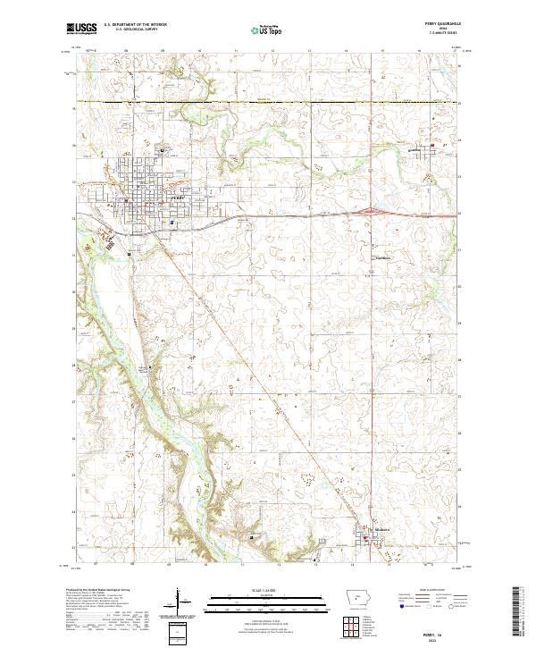
2022 Map of Perry
USGS Topo · Published 2022About this map
The North Raccoon River defines the western landscape of this central Iowa region, winding south past the city of Perry. The area's agricultural and transit legacy is visible in the network of section-line roads and the diagonal path of the Raccoon River Valley Trl, which connects the larger hub of Perry to the smaller settlements of Gardiner and Minburn. Genealogists will find several burial grounds well-documented, including Violet Hill Cem north of Perry and Elmwood Cem near the southern edge of the quadrangle. Smaller watercourses like Beaver Cr and Frog Cr cut through the northern townships of t82n r28w and t82n r27w, marking the transition between the rolling uplands and the river valley. The map also captures the village of Bouton in the northeast, illustrating the enduring grid of these rural Dallas County communities.
Find a feature on this map
62 named features on this map. Tap any name to fly to it.
Don’t see what you’re looking for? This feature index may not catch every label — zoom into the map to look around manually.
Map Details
Editions of this 2022 Perry Map
This is the sole edition of this map. No revisions or reprints were ever made.
Other maps of this area

1908 · Waukee
USGS Topo · 1:62,500

1911 · Madrid
USGS Topo · 1:62,500

1914 · Madrid
USGS Topo · 1:62,500

1949 · Adel
USGS Topo · 1:62,500

1950 · Perry
USGS Topo · 1:62,500

1951 · Perry
USGS Topo · 1:62,500

1951 · Adel
USGS Topo · 1:62,500

1954 · Omaha
USGS Topo · 1:250,000

1954 · Des Moines
USGS Topo · 1:250,000

1956 · Des Moines
USGS Topo · 1:250,000