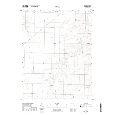
2017 Map of Perry NE
USGS Topo · Published 2017About this map
Madisonville Cem and the small Barron Aviation Airport mark this rural landscape in northeastern Missouri, where the terrain is defined by an intricate network of creeks and branches. The land is heavily dissected by waterways such as Spencer Creek and the Dry Fork, which carve through the townships. The road network is a mix of state highways like State Hwy EE and local routes named for wildlife and presidents, including Kingbird Ln and Truman Ln. This survey shows the persistent agricultural character of Ralls County, with roads like Fern Chapel Rd and Madisonville Rd connecting scattered farmsteads across the township lines of t54n r6w and t55n r6w. Local water features like Jug Run and Hippo Br underscore the drainage patterns that have shaped land use in this region for generations.
Find a feature on this map
57 named features on this map. Tap any name to fly to it.
Don’t see what you’re looking for? This feature index may not catch every label — zoom into the map to look around manually.
Map Details
Editions of this 2017 Perry NE Map
This is the sole edition of this map. No revisions or reprints were ever made.
Other maps of this area

1890 · Louisiana
USGS Topo · 1:125,000

1890 · Mexico
USGS Topo · 1:125,000

1903 · Palmyra
USGS Topo · 1:125,000

1932 · Hannibal
USGS Topo · 1:62,500

1936 · Hannibal
USGS Topo · 1:48,000

1943 · Vandalia
USGS Topo · 1:62,500

1945 · Hannibal
USGS Topo · 1:62,500

1945 · Perry
USGS Topo · 1:62,500

1945 · Vandalia
USGS Topo · 1:62,500

1948 · Quincy
USGS Topo · 1:250,000