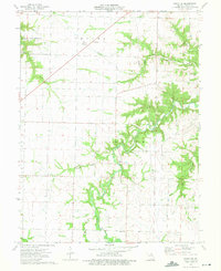
1973 Map of Perry NE
USGS Topo · Published 1975About this map
Clarence Cannon Reservoir dominates the northwestern corner of this Ralls County landscape, reflecting the hydraulic engineering of the early 1970s. The surrounding terrain is defined by a dense network of waterways including the South Fork, Spencer Creek, and Straight Branch, which carve through the townships of Center and Jasper. This era of development is marked by industrial and utility infrastructure, such as a prominent Pipeline, a Pumping Station, and a Radio Tower near the small settlement of Noonan.
Find a feature on this map
22 named features on this map. Tap any name to fly to it.
Don’t see what you’re looking for? This feature index may not catch every label — zoom into the map to look around manually.
Map Details
Editions of this 1973 Perry NE Map
This is the sole edition of this map. No revisions or reprints were ever made.
Other maps of this area

1890 · Louisiana
USGS Topo · 1:125,000

1890 · Mexico
USGS Topo · 1:125,000

1903 · Palmyra
USGS Topo · 1:125,000

1932 · Hannibal
USGS Topo · 1:62,500

1936 · Hannibal
USGS Topo · 1:48,000

1943 · Vandalia
USGS Topo · 1:62,500

1945 · Hannibal
USGS Topo · 1:62,500

1945 · Perry
USGS Topo · 1:62,500

1945 · Vandalia
USGS Topo · 1:62,500

1948 · Quincy
USGS Topo · 1:250,000