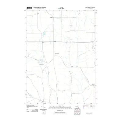
2010 Map of Perrysburg
USGS Topo · Published 2010About this map
Perrysburg and its surrounding hamlets are defined by a complex network of creeks and small agricultural settlements at the start of the 21st century. The landscape is characterized by its drainage into Silver Creek, which feeds the Silver Creek Reservoir, and the waters of East Mud Lake further south. Local commerce and agriculture are noted by the presence of Hanover Hill Farm and the Blueberry Hill Farm And Greenhouse, reflecting the region's enduring farming roots. This 2010 survey shows the persistence of small crossroads communities like Nashville, Smith Mills, and Parcells Corners, which remain distinct even as modern roads like Allegany Rd and County Line Rd connect them. Genealogists can find significant local history at the Perrysburg Cemetery, Cottage Cemetery, and Villenova Cemetery, which serve as anchor points for families across the townships.
Find a feature on this map
56 named features on this map. Tap any name to fly to it.
Don’t see what you’re looking for? This feature index may not catch every label — zoom into the map to look around manually.
Map Details
Editions of this 2010 Perrysburg Map
This is the sole edition of this map. No revisions or reprints were ever made.
Other maps of this area

1899 · Silver Creek
USGS Topo · 1:62,500

1900 · Cherry Creek
USGS Topo · 1:62,500

1905 · Eden
USGS Topo · 1:62,500

1907 · Eden
USGS Topo · 1:62,500

1923 · Cattaraugus
USGS Topo · 1:62,500

1938 · Cattaraugus
USGS Topo · 1:62,500

1941 · Cattaraugus
USGS Topo · 1:62,500

1941 · Cherry Creek
USGS Topo · 1:62,500

1943 · Silver Creek
USGS Topo · 1:24,000

1944 · Eden
USGS Topo · 1:62,500