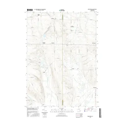
2016 Map of Perrysburg
USGS Topo · Published 2016About this map
Silver Cr Reservoir and the winding course of Silver Creek anchor this Western New York landscape along the border of Chautauqua and Cattaraugus counties. The map captures a transition from the lower elevations of Smith Mills and Balltown in the north toward the rising terrain of the Allegheny Plateau to the south. Small rural communities like Nashville and Parcells Corners define the settlement pattern, which is supported by an extensive network of family-named roads such as Flucker Hill Rd and Hooker Hill Rd.
Find a feature on this map
65 named features on this map. Tap any name to fly to it.
Don’t see what you’re looking for? This feature index may not catch every label — zoom into the map to look around manually.
Map Details
Editions of this 2016 Perrysburg Map
This is the sole edition of this map. No revisions or reprints were ever made.
Other maps of this area

1899 · Silver Creek
USGS Topo · 1:62,500

1900 · Cherry Creek
USGS Topo · 1:62,500

1905 · Eden
USGS Topo · 1:62,500

1907 · Eden
USGS Topo · 1:62,500

1923 · Cattaraugus
USGS Topo · 1:62,500

1938 · Cattaraugus
USGS Topo · 1:62,500

1941 · Cattaraugus
USGS Topo · 1:62,500

1941 · Cherry Creek
USGS Topo · 1:62,500

1943 · Silver Creek
USGS Topo · 1:24,000

1944 · Eden
USGS Topo · 1:62,500