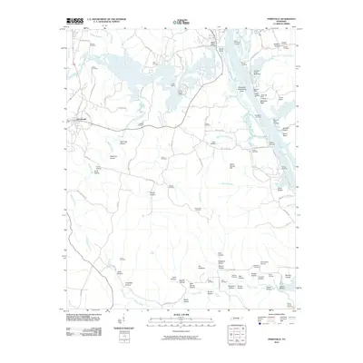
2010 Map of Perryville
USGS Topo · Published 2010About this map
Decaturville serves as the primary settlement hub on this landscape, positioned west of the Tennessee River where the Beech River carves a winding path through the terrain. The riverfront is marked by an extensive network of maritime infrastructure, including Beech River Landing, East Perryville Landing, and the Perryville Dewatering Area. Inland, the map reveals a rugged topography defined by numerous named hollows such as Stillhouse Hollow, Lightning Hollow, and Slabtown Hollow, indicating a history of small-scale industry and secluded settlement. Historical industry is specifically noted at Brownsport Furnace in the southeast, while family history is preserved through dozens of rural burial sites like Luton Cemetery, Houston Cemetery, and Tolley Cemetery, which anchor the various branches and creeks of the Tennessee watershed.
Find a feature on this map
109 named features on this map. Tap any name to fly to it.
Don’t see what you’re looking for? This feature index may not catch every label — zoom into the map to look around manually.
Map Details
Editions of this 2010 Perryville Map
This is the sole edition of this map. No revisions or reprints were ever made.
Other maps of this area

1905 · Waynesboro
USGS Topo · 1:125,000

1936 · Pine View
USGS Topo · 1:24,000

1936 · Scotts Hill
USGS Topo · 1:24,000

1936 · Parsons
USGS Topo · 1:24,000

1936 · Thurman
USGS Topo · 1:24,000

1936 · Bath Springs
USGS Topo · 1:24,000

1936 · Clifton
USGS Topo · 1:24,000

1936 · Jeannette
USGS Topo · 1:24,000

1936 · Perryville
USGS Topo · 1:24,000

1936 · Pope
USGS Topo · 1:24,000