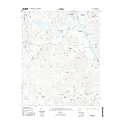
2016 Map of Perryville
USGS Topo · Published 2016About this map
Kentucky Lake dominates the eastern half of this terrain, where the Tennessee River's waters pool against the boundary of Decatur Co and Perry Co. Along the western shore, the settlements of Perryville and Decaturville serve as hubs for a landscape deeply carved by numerous hollows and springs. The map reveals a dense network of local family history through its numerous burial grounds, including Mount Zion Cem, Luton Cem, and Wallace Cem. Local industry and topography are intertwined at The Coalings and Furnace Hollow, suggesting early charcoal production and iron processing sites. From the heights of Spout Spring Hill down to the crossing at Simms Bridge, the topography is defined by the drainage of Rushing Creek and Whites Cr as they flow toward the expansive reservoir.
Find a feature on this map
139 named features on this map. Tap any name to fly to it.
Don’t see what you’re looking for? This feature index may not catch every label — zoom into the map to look around manually.
Map Details
Editions of this 2016 Perryville Map
This is the sole edition of this map. No revisions or reprints were ever made.
Other maps of this area

1905 · Waynesboro
USGS Topo · 1:125,000

1936 · Pine View
USGS Topo · 1:24,000

1936 · Scotts Hill
USGS Topo · 1:24,000

1936 · Parsons
USGS Topo · 1:24,000

1936 · Thurman
USGS Topo · 1:24,000

1936 · Bath Springs
USGS Topo · 1:24,000

1936 · Clifton
USGS Topo · 1:24,000

1936 · Jeannette
USGS Topo · 1:24,000

1936 · Perryville
USGS Topo · 1:24,000

1936 · Pope
USGS Topo · 1:24,000