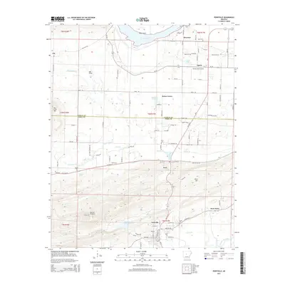
2014 Map of Perryville
USGS Topo · Published 2014About this map
Perryville and Perry serve as the central hubs for this region of Central Arkansas, where the landscape is defined by the winding Arkansas River and its varied tributaries. The northern boundary is marked by Willow Bend, while to the south, the Fouche LaFave River and the S Fouche Site Seven Reservoir dictate the topography of the bottomlands. The map reveals a high density of rural burial sites, such as Wolfe Cem, Harris Cem, and McGhee Cem, which are invaluable for local genealogical research. Distinctive topographic features like Fourche Pinnacle, Perry Mtn, and Rose Creek Mtn rise above the agricultural and residential corridors. Modern infrastructure, including the Brickey Private Airport and a network of state highways like Ar-9 and AR 60 Hwy E, connects dispersed communities like Ada Valley, Oppelo, and Sweet Home.
Find a feature on this map
112 named features on this map. Tap any name to fly to it.
Don’t see what you’re looking for? This feature index may not catch every label — zoom into the map to look around manually.
Map Details
Editions of this 2014 Perryville Map
This is the sole edition of this map. No revisions or reprints were ever made.
Other maps of this area

1889 · Morrilton No. 3
USGS Topo · 1:62,500

1890 · Benton
USGS Topo · 1:125,000

1892 · Morrillton
USGS Topo · 1:125,000

1894 · Morrillton
USGS Topo · 1:125,000

1894 · Benton
USGS Topo · 1:125,000

1955 · Little Rock
USGS Topo · 1:250,000

1956 · Little Rock
USGS Topo · 1:250,000

1956 · Russellville
USGS Topo · 1:250,000

1960 · Little Rock
USGS Topo · 1:250,000

1961 · Perryville
USGS Topo · 1:24,000