
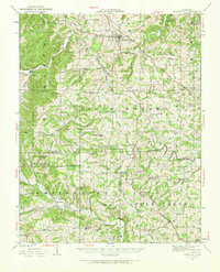
1923 Map of Perryville
USGS Topo · Published 1960About this map
Perryville serves as the focal point of this 1920s survey, surrounded by an intricate landscape of rural schoolhouses and family-named landmarks. The area's settlement pattern is defined by the drainage basins of Apple Creek, Saline Creek, and the Whitewater River, which supported early industry like Bollingers Mill and Conrads Mill. Educational and religious life was deeply decentralized at this time, evidenced by dozens of small institutions such as St Marys Seminary, York Chapel, and the Sim Layton School.
Find a feature on this map
66 named features on this map. Tap any name to fly to it.
Don’t see what you’re looking for? This feature index may not catch every label — zoom into the map to look around manually.
Map Details
Editions of this 1923 Perryville Map
2 editions found
Other maps of this area

1907 · Weingarten
USGS Topo · 1:62,500

1909 · Weingarten
USGS Topo · 1:62,500

1910 · Higdon
USGS Topo · 1:62,500

1915 · Chester
USGS Topo · 1:62,500

1916 · Campbell Hill
USGS Topo · 1:62,500

1918 · Altenburg
USGS Topo · 1:62,500

1918 · Campbell Hill
USGS Topo · 1:62,500

1922 · Cape Girardeau
USGS Topo · 1:62,500

1924 · Cape Girardeau
USGS Topo · 1:62,500

1924 · Perryville
USGS Topo · 1:62,500