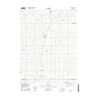
2015 Map of Persia
USGS Topo · Published 2015About this map
Persia stands as the primary settlement in this western Iowa landscape, where the town layout is oriented toward the rail line that follows the path of Mosquito Cr. The surrounding countryside in Harrison County is defined by a dense network of watercourses, including Pigeon Cr and Lytles Cr, which carve through the terrain and dictate the placement of rural homesteads and roads. Further south, the small community of Yorkshire serves as another focal point for local history researchers and genealogists.
Find a feature on this map
38 named features on this map. Tap any name to fly to it.
Don’t see what you’re looking for? This feature index may not catch every label — zoom into the map to look around manually.
Map Details
Editions of this 2015 Persia Map
This is the sole edition of this map. No revisions or reprints were ever made.
Other maps of this area

1954 · Omaha
USGS Topo · 1:250,000

1956 · Underwood
USGS Topo · 1:24,000

1956 · Neola
USGS Topo · 1:24,000

1957 · Omaha
USGS Topo · 1:250,000

1958 · Omaha
USGS Topo · 1:250,000

1963 · Avoca NW
USGS Topo · 1:24,000
1978 · Hard Scratch
USGS Topo · 1:24,000

1978 · Panama
USGS Topo · 1:24,000

1978 · Persia
USGS Topo · 1:24,000
1978 · Woodbine
USGS Topo · 1:24,000