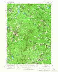
1953 Map of Peterborough
USGS Topo · Published 1967About this map
MacDowell Colony and the Cathedral of the Pines anchor the cultural landscape of this mid-century New Hampshire interior, where small manufacturing villages and hilltop farms define the topography. The Contoocook River and Souhegan River systems dictated the placement of industrial centers like Peterborough and Wilton Center, while the Boston and Maine Railroad provided critical connectivity to the broader New England market through towns such as Bennington and Greenfield.
Find a feature on this map
128 named features on this map. Tap any name to fly to it.
Don’t see what you’re looking for? This feature index may not catch every label — zoom into the map to look around manually.
Map Details
Editions of this 1953 Peterborough Map
3 editions found
Other maps of this area

1887 · Winchendon
USGS Topo · 1:62,500

1887 · Fitchburg
USGS Topo · 1:62,500

1889 · Fitchburg
USGS Topo · 1:62,500

1890 · Winchendon
USGS Topo · 1:62,500

1893 · Fitchburg
USGS Topo · 1:62,500

1893 · Groton
USGS Topo · 1:62,500

1894 · Winchendon
USGS Topo · 1:62,500

1898 · Monadnock
USGS Topo · 1:62,500

1900 · Peterboro
USGS Topo · 1:62,500

1906 · Milford
USGS Topo · 1:62,500