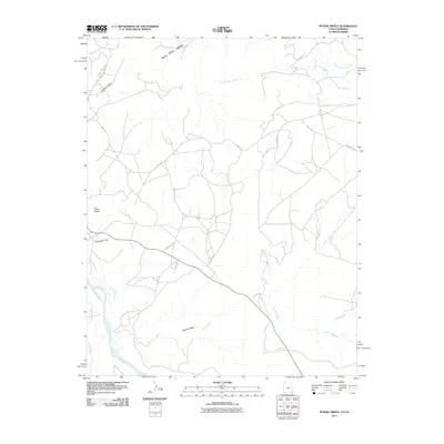
2011 Map of Peters Nipple
USGS Topo · Published 2011About this map
Peters Nipple rises above a high desert landscape marked by intricate drainage networks and ancestral migration routes in the early 21st century. The map centers on the high ground of Mail Trail Mesa and the prominent overlook at Aneth Point, where the terrain drops toward the northern boundary along McElmo Creek. To the south, the San Juan River defines the lower edge of the quadrangle, receiving runoff from several prominent ephemeral drainages including Marble Wash, Coyote Wash, and Tsilah Wash.
Find a feature on this map
16 named features on this map. Tap any name to fly to it.
Don’t see what you’re looking for? This feature index may not catch every label — zoom into the map to look around manually.
Map Details
Editions of this 2011 Peters Nipple Map
This is the sole edition of this map. No revisions or reprints were ever made.
Other maps of this area

1886 · Abajo
USGS Topo · 1:250,000

1892 · Abajo
USGS Topo · 1:250,000

1893 · Abajo
USGS Topo · 1:250,000

1956 · Cortez
USGS Topo · 1:250,000

1957 · Moqui SW
USGS Topo · 1:24,000

1958 · Sentinel Peak NW
USGS Topo · 1:24,000

1958 · Cortez
USGS Topo · 1:250,000

1958 · Aneth 1 SW
USGS Topo · 1:24,000
1958 · Aneth 1 SE
USGS Topo · 1:24,000

1958 · Cajon Mesa
USGS Topo · 1:62,500