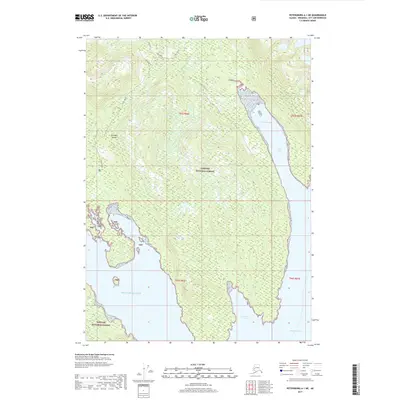
2017 Map of Petersburg A-1 NE
USGS Topo · Published 2017About this map
Wrangell Island dominates this southeastern Alaskan landscape within the southern reaches of the Tongass National Forest. The 2017 survey details the complex shoreline of the Alexander Archipelago, where the island meets the Gulf of Alaska and Ernest Sound. The coastal topography is defined by significant inlets and coves, most notably Fools Inlet and the protected waters of Thoms Place. Small drainage systems like Bozo Creek, Thoms Creek, and Fools Cr carve through the heavily forested interior. This map is particularly useful for understanding the modern boundary of the national forest and the undeveloped character of the island’s southern tip, including Southeast Cove. The lack of road infrastructure outside of established forest tracks reflects the remote nature of this wilderness area at the time of publication.
Find a feature on this map
17 named features on this map. Tap any name to fly to it.
Don’t see what you’re looking for? This feature index may not catch every label — zoom into the map to look around manually.
Map Details
Editions of this 2017 Petersburg A-1 NE Map
This is the sole edition of this map. No revisions or reprints were ever made.
Other maps of this area

1948 · Petersburg A-1
USGS Topo · 1:63,360

1948 · Petersburg B-1
USGS Topo · 1:63,360

1951 · Bradfield Canal
USGS Topo · 1:250,000

1951 · Petersburg A-1
USGS Topo · 1:63,360

1952 · Petersburg
USGS Topo · 1:250,000

1954 · Bradfield Canal
USGS Topo · 1:250,000

1955 · Bradfield canal A-6
USGS Topo · 1:63,360

1955 · Bradfield canal B-6
USGS Topo · 1:63,360

1955 · Petersburg B-1
USGS Topo · 1:63,360

1955 · Bradfield Canal
USGS Topo · 1:250,000