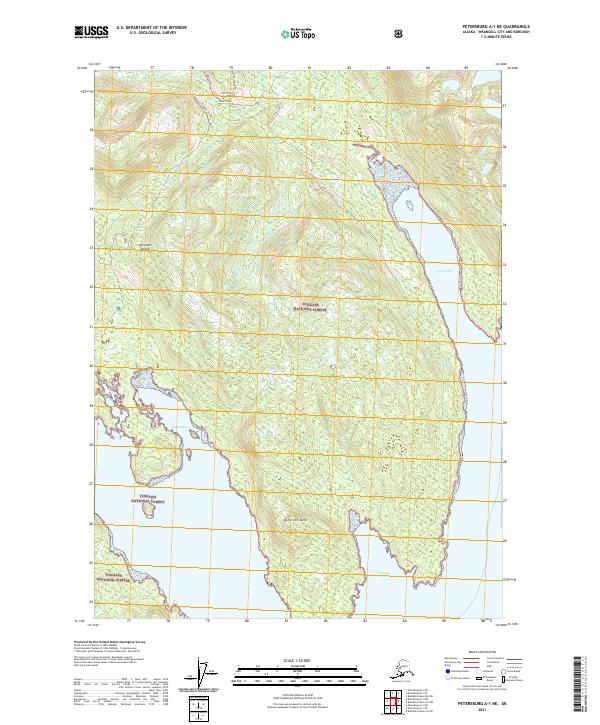
2021 Map of Petersburg A-1 NE
USGS Topo · Published 2021About this map
Wrangell Island dominates this portion of the Alexander Archipelago, showing a landscape defined by dramatic coastal inlets and interior peaks. The southern coastline is marked by Southeast Cove and the protected waters of Thoms Place, while the eastern side of the island is carved by the deep, narrow reaches of Fools Inlet. These waterways provide critical access into the heavily timbered interior of the Tongass National Forest, where drainage systems like Thoms Creek and Bozo Creek flow from the high ground near Atherton Mtn. The map documents a network of primitive tracks, including the Boulder Trl, Wacke Trl, and Bozo Creek Trl, which navigate the steep terrain and connect the shoreline to the inland forests. This modern survey illustrates the enduring intersection of maritime navigation and terrestrial wilderness in Southeast Alaska.
Find a feature on this map
18 named features on this map. Tap any name to fly to it.
Don’t see what you’re looking for? This feature index may not catch every label — zoom into the map to look around manually.
Map Details
Editions of this 2021 Petersburg A-1 NE Map
This is the sole edition of this map. No revisions or reprints were ever made.
Other maps of this area

1948 · Petersburg A-1
USGS Topo · 1:63,360

1948 · Petersburg B-1
USGS Topo · 1:63,360

1951 · Bradfield Canal
USGS Topo · 1:250,000

1951 · Petersburg A-1
USGS Topo · 1:63,360

1952 · Petersburg
USGS Topo · 1:250,000

1954 · Bradfield Canal
USGS Topo · 1:250,000

1955 · Bradfield canal A-6
USGS Topo · 1:63,360

1955 · Bradfield canal B-6
USGS Topo · 1:63,360

1955 · Petersburg B-1
USGS Topo · 1:63,360

1955 · Bradfield Canal
USGS Topo · 1:250,000