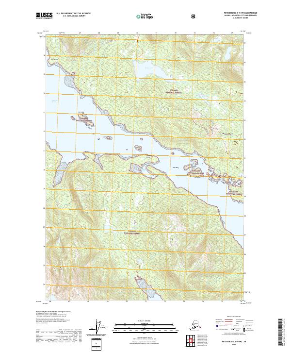
2021 Map of Petersburg A-1 NW
USGS Topo · Published 2021About this map
Tongass National Forest encompasses the entirety of this coastal landscape, where the waters of Zimovia Strait meet the complex shorelines of Wrangell Island. The settlement at Thoms Place serves as a focal point near the southeastern coast, positioned where Thoms Creek drains from the interior high ground. This terrain is characterized by steep elevations like Deer Ridge and significant freshwater bodies such as Thoms Lake. The maritime geography is defined by a series of protected inlets and navigational markers, including Whaletail Cove, Olive Cove, and Turn Point. These features indicate a landscape shaped by both timber resources and coastal navigation. Small landforms like the Village Islands, Button Island, and the Zimovia Islets dot the strait, reflecting the intricate coastal network vital to the region's geography and local transit.
Find a feature on this map
20 named features on this map. Tap any name to fly to it.
Don’t see what you’re looking for? This feature index may not catch every label — zoom into the map to look around manually.
Map Details
Editions of this 2021 Petersburg A-1 NW Map
This is the sole edition of this map. No revisions or reprints were ever made.
Other maps of this area

1948 · Petersburg A-1
USGS Topo · 1:63,360

1948 · Petersburg A-2
USGS Topo · 1:63,360

1948 · Petersburg B-2
USGS Topo · 1:63,360

1948 · Petersburg B-1
USGS Topo · 1:63,360

1951 · Petersburg A-1
USGS Topo · 1:63,360

1952 · Petersburg
USGS Topo · 1:250,000

1953 · Petersburg A-2
USGS Topo · 1:63,360

1953 · Petersburg B-2
USGS Topo · 1:63,360

1955 · Petersburg B-1
USGS Topo · 1:63,360

1960 · Petersburg
USGS Topo · 1:250,000