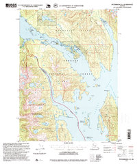
1995 Map of Petersburg A-1
USGS Topo · Published 1999About this map
Wrangell Island and Etolin Island dominate this coastal survey, separated by the deep waters of Zimovia Strait. The landscape is a complex network of glacial fjords and forested peaks, including the high reaches of Mount Etolin and Mount Shakes. Human activity is primarily centered on the shoreline, where maritime infrastructure such as the Crow Log Transfer Facility and several navigational lights support the local timber and fishing economies.
Find a feature on this map
48 named features on this map. Tap any name to fly to it.
Don’t see what you’re looking for? This feature index may not catch every label — zoom into the map to look around manually.
Map Details
Editions of this 1995 Petersburg A-1 Map
This is the sole edition of this map. No revisions or reprints were ever made.
Other maps of this area

1948 · Petersburg A-1
USGS Topo · 1:63,360

1948 · Petersburg A-2
USGS Topo · 1:63,360

1948 · Petersburg B-2
USGS Topo · 1:63,360

1948 · Petersburg B-1
USGS Topo · 1:63,360

1949 · Craig D-2
USGS Topo · 1:63,360

1949 · Craig D-1
USGS Topo · 1:63,360

1951 · Craig D-2
USGS Topo · 1:63,360

1951 · Bradfield Canal
USGS Topo · 1:250,000

1951 · Craig D-1
USGS Topo · 1:63,360

1951 · Petersburg A-1
USGS Topo · 1:63,360