
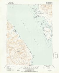
1951 Map of Craig D-2
USGS Topo · Published 1952About this map
Prince of Wales Island and Etolin Island dominate this coastal survey, separated by the deep waters of the Clarence Strait. Compiled from aerial photographs and hydrographic charts in the early 1950s, the map illustrates a maritime landscape where safe harbors were critical for navigation and industry within the Tongass National Forest. Key maritime havens such as McHenry Anchorage and Dewey Anchorage are documented alongside smaller inlets like Ratz Harbor. The terrain is characterized by steep contours rising from the shoreline, punctuated by landmarks such as Narrow Pt and Krogh Lake. The intricate network of smaller landmasses, including Onslow Island, Carlton Island, and Mabel I, highlights the complex geography of the Alexander Archipelago before modern infrastructure altered the regional logistics.
Find a feature on this map
23 named features on this map. Tap any name to fly to it.
Don’t see what you’re looking for? This feature index may not catch every label — zoom into the map to look around manually.
Map Details
Editions of this 1951 Craig D-2 Map
2 editions found
Other maps of this area

1948 · Petersburg A-1
USGS Topo · 1:63,360

1948 · Petersburg A-2
USGS Topo · 1:63,360

1949 · Craig D-3
USGS Topo · 1:63,360

1949 · Craig C-2
USGS Topo · 1:63,360

1949 · Craig D-2
USGS Topo · 1:63,360

1949 · Petersburg A-3
USGS Topo · 1:63,360

1949 · Craig C-3
USGS Topo · 1:63,360

1949 · Craig D-1
USGS Topo · 1:63,360

1950 · Craig D-3
USGS Topo · 1:63,360

1950 · Craig C-1
USGS Topo · 1:63,360