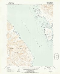
1951 Map of Craig D-2
USGS Topo · Published 1952About this map
Clarence Strait serves as the dominant maritime corridor in this 1951 survey, separating the steep, contour-heavy shores of Prince of Wales Island from the fragmented coastline of Etolin Island. The topography reveals a landscape defined by deep-water access and sheltered maritime havens, most notably at Ratz Harbor and the protected waters of McHenry Anchorage. On the eastern side of the strait, Onslow Island is surrounded by a complex network of smaller features like Carlton Island and Eagle Island, suggesting a region where marine navigation was the primary means of movement. Inland, the presence of Krogh Lake on Etolin Island and the high relief of Prince of Wales reflect the challenging, unroaded nature of the Alexander Archipelago before modern infrastructure reached these outer islands.
Find a feature on this map
24 named features on this map. Tap any name to fly to it.
Don’t see what you’re looking for? This feature index may not catch every label — zoom into the map to look around manually.
Map Details
Editions of this 1951 Craig D-2 Map
2 editions found

Other maps of this area

1948 · Petersburg A-1
USGS Topo · 1:63,360

1948 · Petersburg A-2
USGS Topo · 1:63,360

1949 · Craig D-3
USGS Topo · 1:63,360

1949 · Craig C-2
USGS Topo · 1:63,360

1949 · Craig D-2
USGS Topo · 1:63,360

1949 · Petersburg A-3
USGS Topo · 1:63,360

1949 · Craig C-3
USGS Topo · 1:63,360

1949 · Craig D-1
USGS Topo · 1:63,360

1950 · Craig D-3
USGS Topo · 1:63,360

1950 · Craig C-1
USGS Topo · 1:63,360