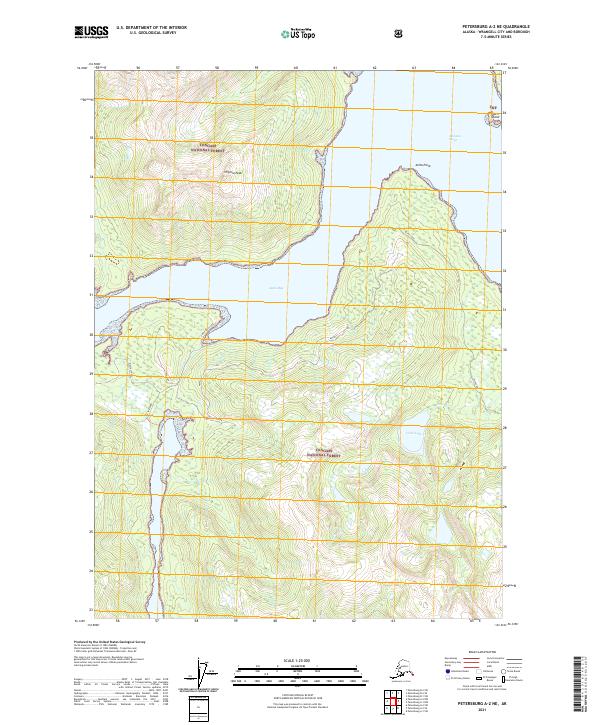
2021 Map of Petersburg A-2 NE
USGS Topo · Published 2021About this map
Virginia Peak dominates the high ground of this coastal Alaskan landscape, situated within the expansive Tongass National Forest. The interaction between the temperate rainforest and the Pacific waterways is evident in the deep indentation of Anita Bay, which separates the northern and southern landmasses. Along the southwestern shore, specific industrial or maritime markers such as E. Shipyard, Mussel Shell, and the Tidal Flat indicate a shoreline defined by tidal movements and localized coastal activity. Access to the interior is limited, primarily represented by the Anita Bay Access and the Olive Cove routes. To the east, Olive Lake feeds into Olive Cr, while the northern waters of Zimovia Strait are dotted by small landforms like Turn Island. This map documents a region where transportation remains tied to the water and established forest access points.
Find a feature on this map
20 named features on this map. Tap any name to fly to it.
Don’t see what you’re looking for? This feature index may not catch every label — zoom into the map to look around manually.
Map Details
Editions of this 2021 Petersburg A-2 NE Map
This is the sole edition of this map. No revisions or reprints were ever made.
Other maps of this area

1948 · Petersburg A-1
USGS Topo · 1:63,360

1948 · Petersburg A-2
USGS Topo · 1:63,360

1948 · Petersburg B-2
USGS Topo · 1:63,360

1948 · Petersburg B-1
USGS Topo · 1:63,360

1951 · Petersburg A-1
USGS Topo · 1:63,360

1952 · Petersburg
USGS Topo · 1:250,000

1953 · Petersburg A-2
USGS Topo · 1:63,360

1953 · Petersburg B-2
USGS Topo · 1:63,360

1955 · Petersburg B-1
USGS Topo · 1:63,360

1960 · Petersburg
USGS Topo · 1:250,000