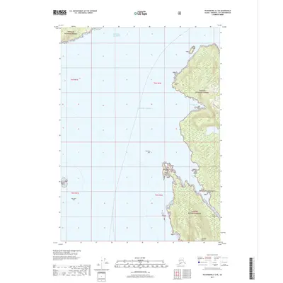
2017 Map of Petersburg A-3 NE
USGS Topo · Published 2017About this map
Etolin Island dominates the southeastern portion of this coastal survey, where the dense canopy of the Tongass National Forest meets the fractured shoreline of Southeast Alaska. The map traces the intricate maritime geography of the Stikine Strait and the open waters of the Gulf of Alaska, punctuated by hazards such as Mariposa Rock and Key Reef. Notable inlets like Steamer Bay and Kindergarten Bay carve into the mountainous terrain, providing natural sheltered anchorages away from the exposed straits. Smaller landmasses including McIver Island, Observation Island, and Independence Island flank the primary coast, while Steamer Knoll rises as a prominent landmark near the southern boundary. This cartographic study illustrates the isolation of the Alaskan panhandle, where transport and industry are inextricably tied to the deep-water channels and rugged island topography.
Find a feature on this map
21 named features on this map. Tap any name to fly to it.
Don’t see what you’re looking for? This feature index may not catch every label — zoom into the map to look around manually.
Map Details
Editions of this 2017 Petersburg A-3 NE Map
This is the sole edition of this map. No revisions or reprints were ever made.
Other maps of this area

1948 · Petersburg A-2
USGS Topo · 1:63,360

1948 · Petersburg B-2
USGS Topo · 1:63,360

1948 · Petersburg B-3
USGS Topo · 1:63,360

1949 · Petersburg A-3
USGS Topo · 1:63,360

1951 · Petersburg B-3
USGS Topo · 1:63,360

1952 · Petersburg
USGS Topo · 1:250,000

1953 · Petersburg A-3
USGS Topo · 1:63,360

1953 · Petersburg A-2
USGS Topo · 1:63,360

1953 · Petersburg B-2
USGS Topo · 1:63,360

1960 · Petersburg
USGS Topo · 1:250,000