
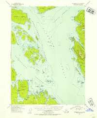
1953 Map of Petersburg A-3
USGS Topo · Published 1954About this map
Prince of Wales Island and Etolin Island define the intricate maritime landscape of this 1953 survey, situated within the Tongass National Forest. The map documents a critical coastal corridor where Clarence Strait meets Stikine Strait, a region historically vital for Southeast Alaska's maritime navigation and fishing industry. Evidence of industrial activity is centered at the Cannery located on the southern shore of Lake Bay, providing a specific look at the local economy before later modern developments.
Find a feature on this map
49 named features on this map. Tap any name to fly to it.
Don’t see what you’re looking for? This feature index may not catch every label — zoom into the map to look around manually.
Map Details
Editions of this 1953 Petersburg A-3 Map
2 editions found
Other maps of this area

1948 · Petersburg A-2
USGS Topo · 1:63,360

1948 · Petersburg B-2
USGS Topo · 1:63,360

1948 · Petersburg B-3
USGS Topo · 1:63,360

1949 · Craig D-3
USGS Topo · 1:63,360

1949 · Craig D-2
USGS Topo · 1:63,360

1949 · Petersburg A-3
USGS Topo · 1:63,360

1949 · Craig D-4
USGS Topo · 1:63,360

1949 · Petersburg A-4
USGS Topo · 1:63,360

1949 · Petersburg B-4
USGS Topo · 1:63,360

1950 · Craig D-3
USGS Topo · 1:63,360