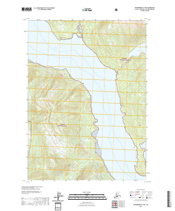
2021 Map of Petersburg B-1 NW
USGS Topo · Published 2021About this map
Eastern Passage dominates the central corridor of this coastal Alaskan landscape, separating the forested heights of the mainland from the surrounding islands. Within the Tongass National Forest, the terrain rises steeply from the shoreline toward named peaks like The Eye Opener. This 2021 survey illustrates a wilderness defined by its water systems, from the expansive Virginia Lake in the northeast to the descent of Rainbow Falls and the drainage of Institute Creek.
Find a feature on this map
15 named features on this map. Tap any name to fly to it.
Don’t see what you’re looking for? This feature index may not catch every label — zoom into the map to look around manually.
Map Details
Editions of this 2021 Petersburg B-1 NW Map
This is the sole edition of this map. No revisions or reprints were ever made.
Other maps of this area

1948 · Petersburg C-1
USGS Topo · 1:63,360

1948 · Petersburg C-2
USGS Topo · 1:63,360

1948 · Petersburg B-2
USGS Topo · 1:63,360

1948 · Petersburg B-1
USGS Topo · 1:63,360

1951 · Petersburg C-2
USGS Topo · 1:63,360

1952 · Petersburg
USGS Topo · 1:250,000

1953 · Petersburg C-1
USGS Topo · 1:63,360

1953 · Petersburg B-2
USGS Topo · 1:63,360

1955 · Petersburg B-1
USGS Topo · 1:63,360

1960 · Petersburg
USGS Topo · 1:250,000