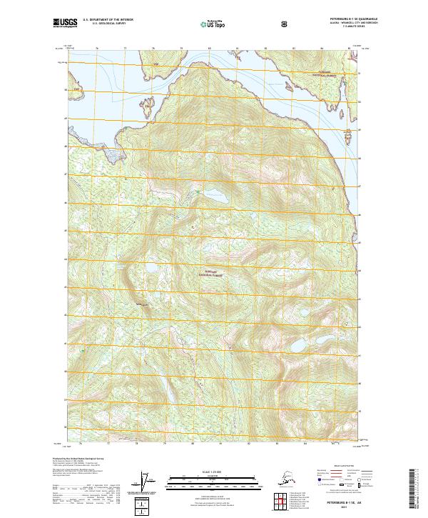
2021 Map of Petersburg B-1 SE
USGS Topo · Published 2021About this map
Tongass National Forest dominates this coastal landscape in the Alexander Archipelago, showing the intricate relationship between the tides and the temperate rainforest. The map details the southeastern portion of Wrangell City and Borough, where the waters of The Narrows and Blake Channel meet near Berg Bay. This interior terrain is defined by steep elevations surrounding inland water bodies like Highbush Lake and Long Lake, which feed into the coastal estuaries. The presence of remote routes such as Uproot Trl and Wacke Trl indicates the limited human footprint in this wilderness area, primarily used for forest management and subsistence. Researchers can trace the complex drainage patterns from Beaver Creek and Stumble Creek into the tidal flats of Fools Inlet and the Earl West Marsh.
Find a feature on this map
26 named features on this map. Tap any name to fly to it.
Don’t see what you’re looking for? This feature index may not catch every label — zoom into the map to look around manually.
Map Details
Editions of this 2021 Petersburg B-1 SE Map
This is the sole edition of this map. No revisions or reprints were ever made.
Other maps of this area

1948 · Petersburg A-1
USGS Topo · 1:63,360

1948 · Petersburg B-1
USGS Topo · 1:63,360

1951 · Bradfield Canal
USGS Topo · 1:250,000

1951 · Petersburg A-1
USGS Topo · 1:63,360

1952 · Petersburg
USGS Topo · 1:250,000

1954 · Bradfield Canal
USGS Topo · 1:250,000

1955 · Bradfield canal A-6
USGS Topo · 1:63,360

1955 · Bradfield canal B-6
USGS Topo · 1:63,360

1955 · Petersburg B-1
USGS Topo · 1:63,360

1955 · Bradfield Canal
USGS Topo · 1:250,000