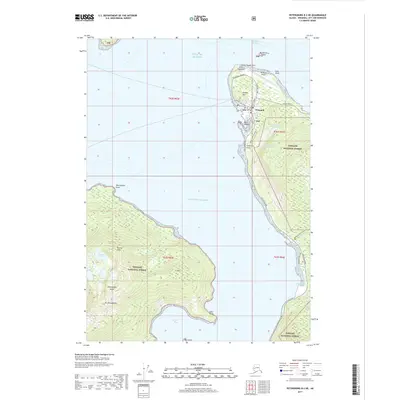
2017 Map of Petersburg B-2 NE
USGS Topo · Published 2017About this map
Wrangell occupies the northern tip of the island where the Eastern Passage meets the Gulf of Alaska. The town's grid is constrained by the rising elevations of Dewey Hill, with major thoroughfares like Evergreen Avenue and the southern-reaching Zimovia Highway providing primary access. This 2017 survey details the infrastructure essential to this coastal community, from the Wrangell Airport at Point Highfield to the Wrangell Upper Reservoir and Wrangell Lower Reservoir providing water from the heights above the settlement. Across the water to the west, the steep terrain of Woronkofski Island is dominated by Sunrise Peak and Mt Woronkofski, while the southern reaches of the mainland shore feature recreational paths such as the Rainbow Falls Trail and the Shoemaker Bay Loop near Shoemaker Bay.
Find a feature on this map
42 named features on this map. Tap any name to fly to it.
Don’t see what you’re looking for? This feature index may not catch every label — zoom into the map to look around manually.
Map Details
Editions of this 2017 Petersburg B-2 NE Map
This is the sole edition of this map. No revisions or reprints were ever made.
Other maps of this area

1948 · Petersburg C-1
USGS Topo · 1:63,360

1948 · Petersburg C-2
USGS Topo · 1:63,360

1948 · Petersburg B-2
USGS Topo · 1:63,360

1948 · Petersburg B-1
USGS Topo · 1:63,360

1951 · Petersburg C-2
USGS Topo · 1:63,360

1952 · Petersburg
USGS Topo · 1:250,000

1953 · Petersburg C-1
USGS Topo · 1:63,360

1953 · Petersburg B-2
USGS Topo · 1:63,360

1955 · Petersburg B-1
USGS Topo · 1:63,360

1960 · Petersburg
USGS Topo · 1:250,000