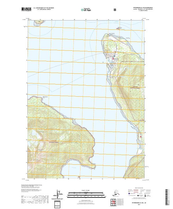
2021 Map of Petersburg B-2 NE
USGS Topo · Published 2021About this map
Wrangell serves as the focal point of this coastal survey, situated on the northern tip of an island landscape defined by steep peaks and narrow passages. The town's layout is clearly delineated by streets such as Bennett St and Case Ave, leading south toward Cemetery Point and Point Shekesti. A primary transportation corridor, the Zimovia Highway, traces the western shoreline toward Shoemaker Bay, providing a vital link for the community's maritime and aviation infrastructure, including the Wrangell Airport at Polk Point.
Find a feature on this map
41 named features on this map. Tap any name to fly to it.
Don’t see what you’re looking for? This feature index may not catch every label — zoom into the map to look around manually.
Map Details
Editions of this 2021 Petersburg B-2 NE Map
This is the sole edition of this map. No revisions or reprints were ever made.
Other maps of this area

1948 · Petersburg C-1
USGS Topo · 1:63,360

1948 · Petersburg C-2
USGS Topo · 1:63,360

1948 · Petersburg B-2
USGS Topo · 1:63,360

1948 · Petersburg B-1
USGS Topo · 1:63,360

1951 · Petersburg C-2
USGS Topo · 1:63,360

1952 · Petersburg
USGS Topo · 1:250,000

1953 · Petersburg C-1
USGS Topo · 1:63,360

1953 · Petersburg B-2
USGS Topo · 1:63,360

1955 · Petersburg B-1
USGS Topo · 1:63,360

1960 · Petersburg
USGS Topo · 1:250,000