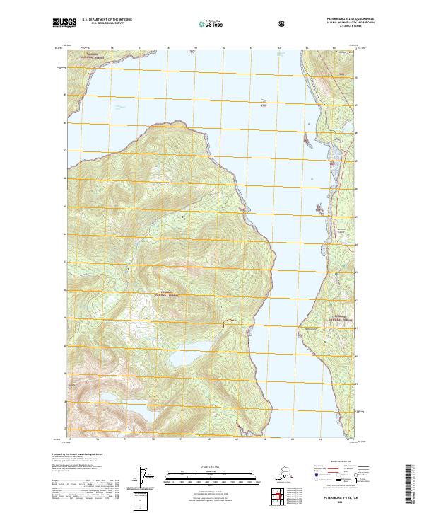
2021 Map of Petersburg B-2 SE
USGS Topo · Published 2021About this map
Zimovia Strait divides the southeastern landscape of this region, separating the interior of Etolin Island from the coastal edge of Wrangell Island. The terrain is dominated by the sprawling Tongass National Forest, which covers the high elevations of Bessie Peak and Helen Peak in the southwest. Transport in this maritime environment is defined by the Zimovia Highway and Zimovia FH 16 running along the eastern shoreline, providing access to inland features like Pats Lake and the Pats Trl. The map illustrates a classic Southeast Alaska interface between deep water channels and steep, forested mountain slopes. Significant freshwater bodies such as Kunk Lake drain through Kunk Cr toward the strait, while coastal landmarks like Nemo Point serve as geographic anchors for navigators moving through the Chishagof Pass.
Find a feature on this map
27 named features on this map. Tap any name to fly to it.
Don’t see what you’re looking for? This feature index may not catch every label — zoom into the map to look around manually.
Map Details
Editions of this 2021 Petersburg B-2 SE Map
This is the sole edition of this map. No revisions or reprints were ever made.
Other maps of this area

1948 · Petersburg A-1
USGS Topo · 1:63,360

1948 · Petersburg A-2
USGS Topo · 1:63,360

1948 · Petersburg B-2
USGS Topo · 1:63,360

1948 · Petersburg B-1
USGS Topo · 1:63,360

1951 · Petersburg A-1
USGS Topo · 1:63,360

1952 · Petersburg
USGS Topo · 1:250,000

1953 · Petersburg A-2
USGS Topo · 1:63,360

1953 · Petersburg B-2
USGS Topo · 1:63,360

1955 · Petersburg B-1
USGS Topo · 1:63,360

1960 · Petersburg
USGS Topo · 1:250,000