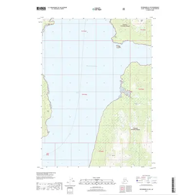
2017 Map of Petersburg B-2 SW
USGS Topo · Published 2017About this map
Stikine Strait serves as the central waterway of this coastal survey, dividing the mountainous terrain of the Tongass National Forest into distinct western and eastern shores. To the east, the landscape is defined by high elevations, including Sunset Peak and Red Mtn, while the western shoreline is punctuated by prominent coastal markers such as Round Point. The marine geography is further detailed by named features like Drag Island and the exposed Reef Point. The coastal forests are traversed by forest roads such as Newlywed and Fishtrap, which indicate access routes through the dense timber of the region. This 2017 edition reflects the modern boundaries of the Tongass while providing a clear view of the deep channels and shorelines where the inland waters meet the Gulf of Alaska.
Find a feature on this map
17 named features on this map. Tap any name to fly to it.
Don’t see what you’re looking for? This feature index may not catch every label — zoom into the map to look around manually.
Map Details
Editions of this 2017 Petersburg B-2 SW Map
This is the sole edition of this map. No revisions or reprints were ever made.
Other maps of this area

1948 · Petersburg A-2
USGS Topo · 1:63,360

1948 · Petersburg B-2
USGS Topo · 1:63,360

1948 · Petersburg B-3
USGS Topo · 1:63,360

1949 · Petersburg A-3
USGS Topo · 1:63,360

1951 · Petersburg B-3
USGS Topo · 1:63,360

1952 · Petersburg
USGS Topo · 1:250,000

1953 · Petersburg A-3
USGS Topo · 1:63,360

1953 · Petersburg A-2
USGS Topo · 1:63,360

1953 · Petersburg B-2
USGS Topo · 1:63,360

1960 · Petersburg
USGS Topo · 1:250,000