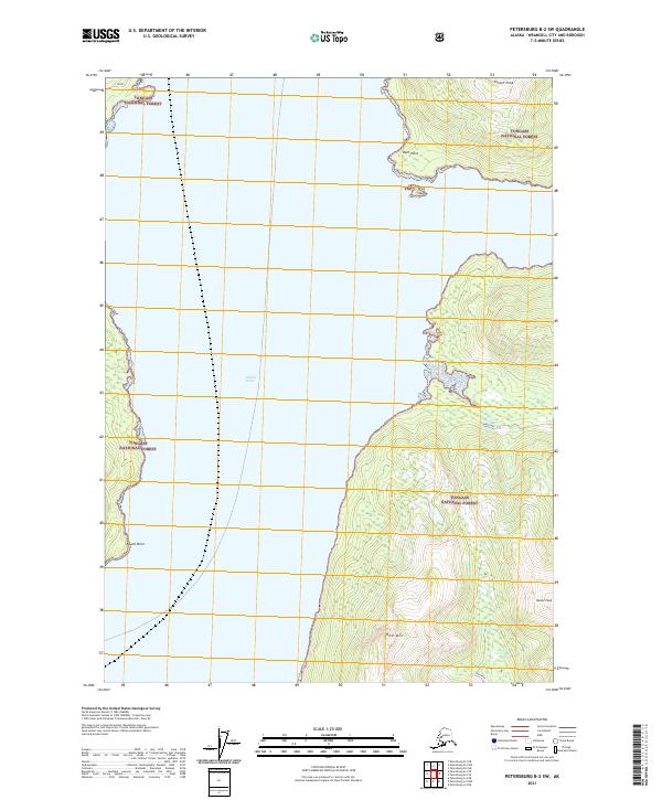
2021 Map of Petersburg B-2 SW
USGS Topo · Published 2021About this map
Stikine Strait dominates this coastal landscape within the Tongass National Forest, serving as a central maritime corridor between the forested shorelines of Southeast Alaska. This 2021 study illustrates the topography of the Wrangell area, where the terrain rises sharply from the water to prominent summits such as Sunset Peak and Bessie Peak in the northeast and Red Mtn to the south. Small coastal markers like Reef Point and Drag Island line the eastern shore, while Round Point defines a western bend in the strait. The presence of routes labeled Newlywed and Fishtrap suggest local land use or forestry access within the mountainous interior, providing a detailed record of the road and trail network as it existed in the early 21st century.
Find a feature on this map
16 named features on this map. Tap any name to fly to it.
Don’t see what you’re looking for? This feature index may not catch every label — zoom into the map to look around manually.
Map Details
Editions of this 2021 Petersburg B-2 SW Map
This is the sole edition of this map. No revisions or reprints were ever made.
Other maps of this area

1948 · Petersburg A-2
USGS Topo · 1:63,360

1948 · Petersburg B-2
USGS Topo · 1:63,360

1948 · Petersburg B-3
USGS Topo · 1:63,360

1949 · Petersburg A-3
USGS Topo · 1:63,360

1951 · Petersburg B-3
USGS Topo · 1:63,360

1952 · Petersburg
USGS Topo · 1:250,000

1953 · Petersburg A-3
USGS Topo · 1:63,360

1953 · Petersburg A-2
USGS Topo · 1:63,360

1953 · Petersburg B-2
USGS Topo · 1:63,360

1960 · Petersburg
USGS Topo · 1:250,000