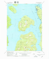
1953 Map of Petersburg B-2
USGS Topo · Published 1979About this map
Wrangell serves as the focal point of this coastal survey, situated on the northern tip of Wrangell Island where the Zimovia Strait meets the Eastern Passage. The town's maritime and aviation infrastructure is clearly defined, including the Wrangell Airport, a Seaplane Base, and Wrangell Harbor. Just south of the main settlement, the Wrangell Institute and local landmarks like Dewey Hill and Cemetery Pt provide specific points for historical research.
Find a feature on this map
62 named features on this map. Tap any name to fly to it.
Don’t see what you’re looking for? This feature index may not catch every label — zoom into the map to look around manually.
Map Details
Editions of this 1953 Petersburg B-2 Map
3 editions found

Other maps of this area

1948 · Petersburg A-1
USGS Topo · 1:63,360

1948 · Petersburg A-2
USGS Topo · 1:63,360

1948 · Petersburg C-1
USGS Topo · 1:63,360

1948 · Petersburg C-2
USGS Topo · 1:63,360

1948 · Petersburg B-2
USGS Topo · 1:63,360

1948 · Petersburg B-1
USGS Topo · 1:63,360

1948 · Petersburg C-3
USGS Topo · 1:63,360

1948 · Petersburg B-3
USGS Topo · 1:63,360

1949 · Petersburg A-3
USGS Topo · 1:63,360

1951 · Petersburg B-3
USGS Topo · 1:63,360