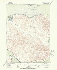
1951 Map of Petersburg B-3
USGS Topo · Published 1954About this map
Zarembo Island dominates this mid-century survey of the Alexander Archipelago, showing the island's complex topography within the Tongass National Forest. The map details the vital maritime corridors of the Sumner Strait to the north and Clarence Strait to the southwest, which served as essential waterways for the region's navigation. Sheltered anchorages like Baht Harbor and St John Harbor are clearly marked, alongside coastal features such as Little Baht Hbr and Meter Bight.
Find a feature on this map
20 named features on this map. Tap any name to fly to it.
Don’t see what you’re looking for? This feature index may not catch every label — zoom into the map to look around manually.
Map Details
Editions of this 1951 Petersburg B-3 Map
2 editions found

Other maps of this area

1948 · Petersburg A-2
USGS Topo · 1:63,360

1948 · Petersburg C-4
USGS Topo · 1:63,360

1948 · Petersburg C-2
USGS Topo · 1:63,360

1948 · Petersburg B-2
USGS Topo · 1:63,360

1948 · Petersburg C-3
USGS Topo · 1:63,360

1948 · Petersburg B-3
USGS Topo · 1:63,360

1949 · Petersburg A-3
USGS Topo · 1:63,360

1949 · Petersburg A-4
USGS Topo · 1:63,360

1949 · Petersburg B-4
USGS Topo · 1:63,360

1951 · Petersburg B-4
USGS Topo · 1:63,360