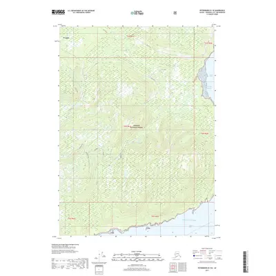
2017 Map of Petersburg B-3 SE
USGS Topo · Published 2017About this map
Wrangell and its surrounding coastal wilderness are documented in this 2017 survey of the Alexander Archipelago. This portion of the Tongass National Forest is defined by complex shorelines and sharp elevation changes, where the protected waters of Stikine Strait meet the open Gulf of Alaska. The landscape is characterized by a series of prominent ridges and drainages, notably Nebitt Ridge, which separates coastal inlets from interior basins like Mustang Lake. High-altitude transitions are marked by Vial Pass and the Vial Divide, providing clear evidence of the area's difficult overland movement. Along the northern coast, Meter Bight and Azure indicate the importance of the maritime environment to this region of Southeast Alaska, while the interior remains a largely undeveloped forest network punctuated by isolated water bodies like Flying Fish.
Find a feature on this map
19 named features on this map. Tap any name to fly to it.
Don’t see what you’re looking for? This feature index may not catch every label — zoom into the map to look around manually.
Map Details
Editions of this 2017 Petersburg B-3 SE Map
This is the sole edition of this map. No revisions or reprints were ever made.
Other maps of this area

1948 · Petersburg A-2
USGS Topo · 1:63,360

1948 · Petersburg B-2
USGS Topo · 1:63,360

1948 · Petersburg B-3
USGS Topo · 1:63,360

1949 · Petersburg A-3
USGS Topo · 1:63,360

1951 · Petersburg B-3
USGS Topo · 1:63,360

1952 · Petersburg
USGS Topo · 1:250,000

1953 · Petersburg A-3
USGS Topo · 1:63,360

1953 · Petersburg A-2
USGS Topo · 1:63,360

1953 · Petersburg B-2
USGS Topo · 1:63,360

1960 · Petersburg
USGS Topo · 1:250,000